Battle Of Gettysburg Cyclorama
_______________________
Antique Maps Page 1...
CONTINENTS & COUNTRIES, etc.
.JPG)
Jodocus Hondius: "Virginiae Item et Floridae Americae Provinciarum, Nova Descriptio" Hand-colored copper engraving from 1633, French Version. 17" x 21 5/8" - $3000
.JPG)
Emmanuel Bowen: "An Accurate Map of North America Drawn From The Best Modern Maps and Charts and Regulated by Astronomical Observations" 1747 Original Copperplate Engraving on Laid Paper. Plate measures 8 1/4" x 6 1/2;" sheet is 7 7/8" x 9 5/8." - $450
.JPG)
Emmanuel Bowen: "An Accurate Map of the West Indies" 1747 London, Original Hand-Colored Copperplate Engraving on Laid Paper. Rub hole on right plate mark just below the 20th line of Latitude. Map appears to have been professionally cleaned. Plate measures 13 7/8" x 16 3/4;" sheet is 16 3/8" x 18 1/8." - $650
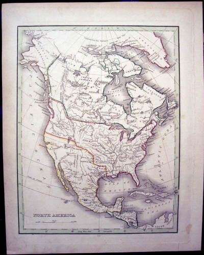
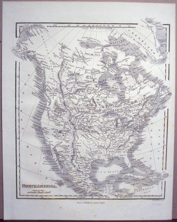
T. G. Bradford: "North America," 1835. Some light toning and foxing, with a very light crease in the upper left-hand quadrant. Sheet measures 12 1/4" x 9 1/2." - $200
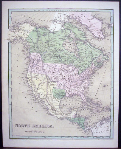
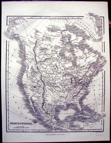
Thomas G. Bradford: "North America," 1838 Original Hand-Colored Engraving. Sheet measures 16" x 12 5/8." - $350
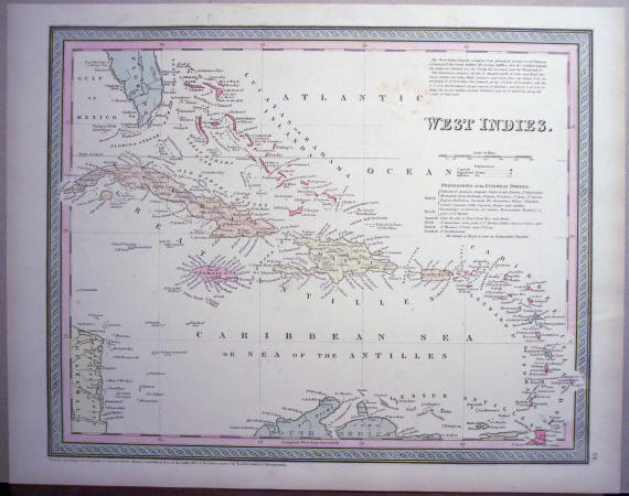
Thomas Cowperthwait: "West Indies" 1850 Original Hand-Colored Engraving, measuring 13 1/4" x 17." - $180
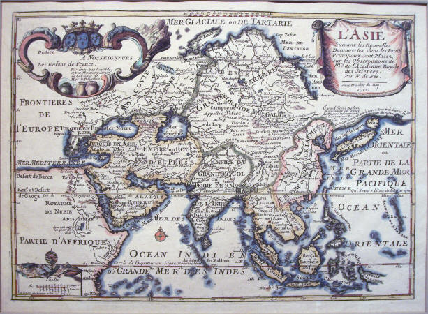
Nicolas de Fer: "L'Aise Suivant Les Nouvelles Decouvertes dont les Point Principaux Sont Places sur les Observations de Mrs. de L'Academie Royal des Sciences." Original Hand-Colored Map of Asia, including part of Africa, 1700. Beautiful coloring; paper is lightly toned with a stain in the upper left corner (Slightly entering cartouche) and stains in the lower margin which do not affect the image. Sheet measures 11 1/8" x 16 1/4;" matting is 15 3/4" x 19 1/2." - $425
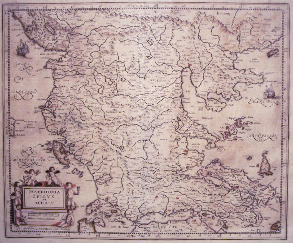
Gerard Mercator: "Macedonia, Epirus et Achaia," ca. 1606 Amsterdam. Hand-colored in outline by a contemporary hand. Latin text on verso. Toned and foxed overall; sheet measures 19 1/4" x 23." - $450
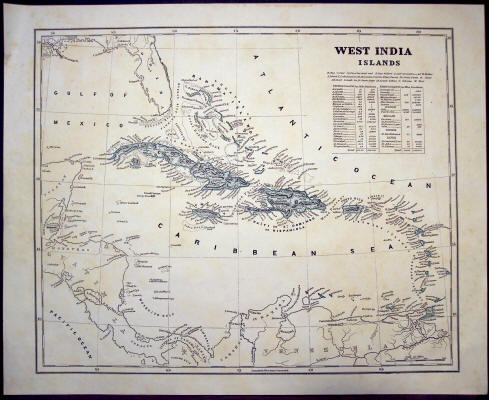
Morse and Breese: "West India Islands," 1842. Colored cerograph measuring 13 11/16" x 16 7/8." Light foxing and toning throughout. - $150
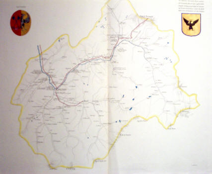
Moutiers & Tarantasia, France. Inscribed "Stati Della R. Casa di Savoja," as this is a beautiful hand-colored outline map of this region, ca. 1810. Measures 19 5/16" x 26 1/8." - $150
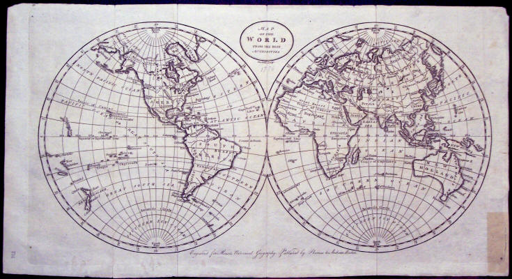
Doolittle Sculp.: "Map of the World From the Best Authorities," 1796. Engraved for Morse's Universal Geography, Published by Thomas & Andrews, Boston. Map is on laid paper, measuring 8 3/8" x 15 1/2." There is a 1 1/4" tear of the plate mark impression in the lower right corner with stain from old repair tape and a 3/8" tear on the fold in the lower left-hand corner. Rare Doolittle engraving. - $185
Samuel Walker: "North America," ca. 1834. Original Uncolored Engraving. Sheet measures 11 1/4" x 8 7/8." - $100
Samuel Walker: "North America," 1840. Some light folds in margins only. Sheet measures 11 1/4" x 8 1/2." - $125
See More Maps...
USA - WESTERN USA - CENTRAL USA - SE USA 1 - SE USA 2 - NE USA 1 - NE USA 2