Battle Of Gettysburg Cyclorama
_______________________
Antique Maps Page 7...
NORTHEASTERN USA (CT, NH, ME, MS, RI, VT)
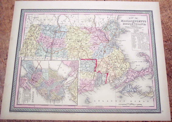
Thomas Cowperthwait & Co. "Map of Massachusetts and Rhode Island" 1850. Hand-colored engraved map with an inset view of Boston. Light toning with a 2" dark blue pen mark traversing a road in the NE part of the state. Map measures 13 3/8" x 16 3/4." - $185
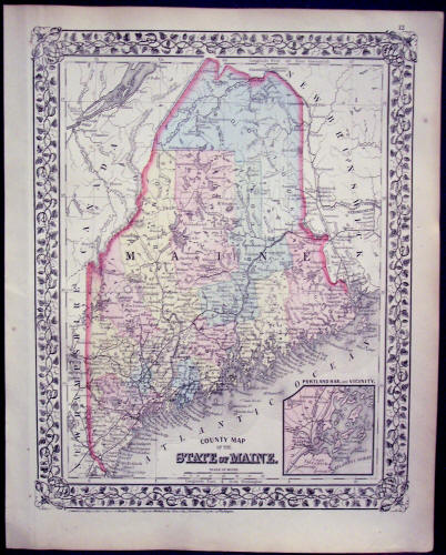
S. Augustus Mitchell: "County Map of the State of Maine," 1874. Original Hand-Colored Single-Page Map from Mitchell's New General Atlas. Measures 15 1/4" x 12 1/4." Some light foxing. - $85
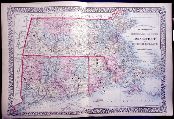
S. Augustus Mitchell: "County and Township Map of the States of Massachusetts, Connecticut and Rhode Island," 1874. Original Hand-Colored Double-Page Map from Mitchell's New General Atlas. Measures 15 1/4" x 23." Light foxing. - $95
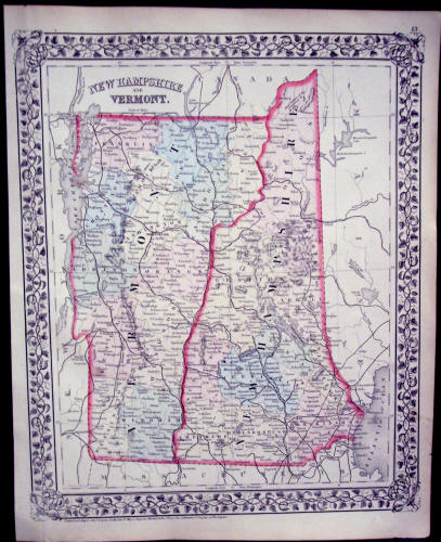
S. Augustus Mitchell: "New Hampshire and Vermont," 1874. Original Hand-Colored Single-Page Map from Mitchell's New General Atlas. Measures 15 1/4" x 12 1/4." Some light foxing. - $90
See More Maps...
CONTINENTS & COUNTRIES - USA - WESTERN USA - CENTRAL USA - SE USA 1 - SE USA 2 - NE USA 2